Bramston Beach
 Bramston Beach and Cooper Point
The drive to Bramston Beach from Miriwinni takes only 20 minutes but is very special – especially the views of Mt Bartle Frere (Qld's highest) and Mt Bellenden Ker (2nd highest) on the return.
 Mt Bartle Frere from Bramston Beach road
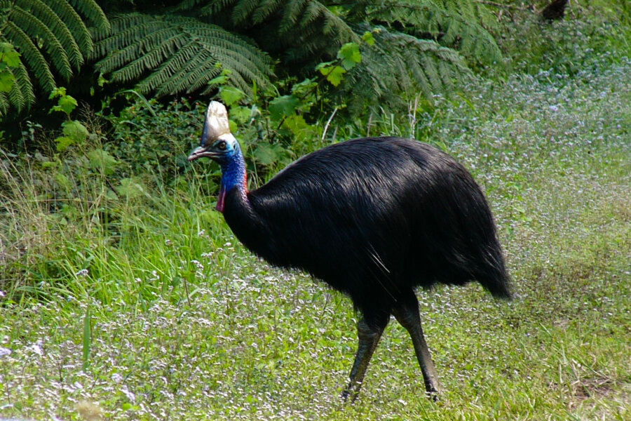
The section through the Graham Range rainforest as it comes down onto the Wyvuri swamp is gorgeous. You may even be lucky enough to see a Cassowary here.
For more information about Cassowaries and where to find them, click Cassowary
 Cassowary on Buckland's road to Bramston Beach
Bramston is still a quiet beach with few facilities (1 shop, a campground and a motel) and would suit visitors who like fishing and walking. There are no houses for 20km north or south of Bramston and the beaches are a beachcomber's paradise.
 Bramston Beach with the Bellenden Ker range behind
 Paperbarks (melaleucas) line the beach
 Bramston is a small beach community with one main street
North Bramston beach is part of the National Park and it is possible to walk all the way to Russell Heads which is a tiny isolated community at the mouth of the Mulgrave River with no road access. With a 4WD you can drive the 18km to the end of the track in the Graham range National Park. The road starts at Sassafras St which is on the left just before the motel as you enter Bramston. You can camp in the National Park but must pay the camp fee – there is a box for paying the fee at the entrance. From the end of the track you can walk about 11km at low tide to the point from where you can see the small settlement of Russell Heads which is a further 5km walk. Low tide is not essential but it does save some scrambling over the huge granite boulders which tumble down into the sea in several places. In August these boulders are festooned with flowering Golden Orchids.
 North Bramston to Fitzroy Island
 The lake fed by Bluemetal Ck behind the beach at Nth Bramston
 Bluemetal Creek running out of the lake
The beach to the south of Bramston runs for 4km. Further walking is blocked by the jungle covered headland of Cooper Point. his is an easy walk. There is a great little sandy beach amongst the rocks and trees below Cooper Point to rest up in the shade and break out the picnic. There is also good snorkeling and fishing off the rocks.
 Bramston Station & South Bramston Beach
 Cooper Point
Eubenangee Swamp is just off the road into Bramston. Turn right just before the Alice Creek bridge, drive about 3km and you will see the sign and parking spot on the right. Follow the creek through the forest and climb the hill behind for a wonderful view. Spectacular on a winter morning with the mist rising and Queensland's largest mountains behind.
 Eubenangee & Mt Bellenden Ker
 Eubenangee after heavy rain
 The Eubenangee walk along the Alice River takes you out to the bright green round hill (lower left)
Search:


